The Map of Ethiopia is a fully editable presentation graphic designed for PowerPoint and Google Slides.
Customizable Ethiopian Map with Regional and City Highlights
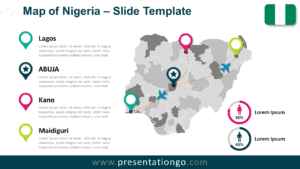
The template features a gray silhouette map of Ethiopia with clearly defined outlines for all twelve regional states and two chartered cities. Each boundary is precisely traced to support regional analysis. It includes four color-coded location markers—Moyale, Addis Ababa, Dolo Odo, and Werder—each labeled with editable placeholders. An Ethiopian flag subtly positioned in the top-right corner reinforces the map’s national identity. Two circular infographic indicators with male and female gender icons help illustrate demographic data or any quantitative metrics with clarity and precision.
Country maps are valuable tools in various presentation settings. Business analysts might use this map to identify new market opportunities across different Ethiopian regions. Similarly, educators can showcase geographic or sociopolitical distinctions during a classroom lecture. In addition, government or nonprofit researchers may use the map to present demographic trends or compare regional statistics during stakeholder meetings.
This template includes two versatile slides. It allows full customization of all elements, including each state and city marker. Users can adapt color schemes to match their brand or thematic tone. The map highlights Ethiopia’s twelve states and two chartered cities, supporting detailed visual storytelling. The slides are provided in both 4:3 and 16:9 formats and are available in light and dark themes. Furthermore, the template is compatible with both PowerPoint (PPTX) and Google Slides platforms.
Download now this editable map of Ethiopia with 14 customizable regions and two layout options.
Widescreen (16:9) size preview:


This template offers:
- 2 unique slide layouts
- Light and dark background theme options
- Pre-filled with icons, percentage indicators, and text placeholders
- Fully editable vector shapes for regions and prefectures
- Available in both Standard (4:3) and Widescreen (16:9) formats
- Compatible with PowerPoint (PPTX) and Google Slides